I just arrived in Ushuaia today, the southernmost city in the world! It is in the southern part of Tierra del Fuego along the Beagle Channel. This is also the first time I have been in Argentina thus far. As best I can tell, Argentina totally rocks, and I´m already feeling better about being here than I´ve felt in Chile in the past few weeks.
Tierra del Fuego is stunning. On the trip down from Punta Arenas, we crossed the Straight of Magellan, and then continued accross a desolate, gravel road through the Tierra. The first thing you notice is the sky, which spans endlessly as far as you can see in all directions. It is a rich blue, dotted with clouds like you might see from an airplane at 36,000ft. Then as we cruise the barren, windswept nothingness, we pass by some ponds, teaming with bright Pink Flamingos. Really. Thousands of them. They effortlessly run across the water, like ice skaters doing a well rehearsed performance. We make a rest stop in San Sebastian, 5km short of the border with Argentina. The bus stops for 30 minutes, but in the short time its easy to see why people call this 'the
As I get off the bus, the sun is shinning. A stiff breeze blows, but not too hard. In the distance, a grayish haze lurks. The wind picks up to a gusty 50-something MPH and the air turns cold. The Grey haze advances rapidly, like a swarm of bees disturber out of their hive. Within minutes, the rain begins to fall. It gets colder. Then the hail comes, hard and biting, clicking lightly on the plastic cover at the rest stop.
Just as fast as the hail starts, it eases off to a pounding rain, drops hitting hard and splattering the gravel; attaching more dirt to the already dusty Bus. The wind continues to usher the torment along, as if it has other things to do and can't afford a bit more time with us. And then it is gone. The flamingos fly by, a pink flutter signaling the passing of a nemesis.
The rest of the drive is scenic and beautiful, easing into the Tierra del Fuego Andes, the southernmost part of the andes that rise dramatically from the Beagle Channel. The mountains are dramatic and we´re graced with clear weather and great views of lakes, mountauns and sky.
Shortle after passing km 3000 on the Argentine Hwy 3, we round a corner to a spectacular double rainbow, as if signaling the entrance to Ushuaia. The rainbow streches from mountain to mountain, arching over the arid forrests that look like they belong at 10,000ft, even though we are at sea level. The windswept land and rugged mountains rise from the sea, streching into the blue sky, and then dropping in front of us into the Beagle Channel and behind Navarino Island. Boats dot the horizon of this stunning sea scape. Welcome to Ushuaia.
Monday, December 31, 2007
Wednesday, December 26, 2007
12/17-12/24 - Grand Circuito, Torres del Paine National Park, Chile
The Grand Paine Circuit in Torres del Paine National Park, Chile, is an 8 day, 124km trek through some of the most spectacular scenery in Southern Chile. The trek is one of the most popular in Chile, so it has been developed for tourism with hostals, accomodation and transportation within the park. I´d say the development is more complete than a place like Yosemite, although not designed to handle so many people. The play by play is below, but if you want some interesting tidbits without reading the whole thing:
-The actual Torres (Towers) weren't nearly as impressive as the Grey Glacier
-You can drink the water anywhere in the park without treatment (lakes, rivers, streams, glaciers, huts...), so you don´t really need to carry any
-There are places along the way to buy food, gas, and rent gear, so you don´t really need to bring any of that either...
-The weather in Patagonia in the middle of the summer is erratic and unpredictable. We saw rain, snow, sun, hail and knock-you-on-your-ass winds almost daily.
-Paying US$7 per person to pitch a tent is the norm
-Passing day trippers with daypacks is infuriating when you're carrying a 40lb pack with 8 days worth of gear and food
-There are some good first decents to be had if you´re willing to carry a kayak 10-20 miles
-Climbers on the Torres often spend 15-30 days on the wall; way more core than kayaking
-The Torres at sunrise cast a red glow for about 2 minutes if it is clear outside
-The Torres are particularly spectacular because they are granite spires capped with a dark layer of shale, a rare geologic formation
12/17 - Day 1, Puerto Natales to Laguna Amargo (bus), Laguna Amargo to Camp Seron, 20km (7km in bus)
The first day of the trek began early with a 7am bus to the park (US$18R/T). The three hour bus ride stops at the guard house, where you purchase a park pass (US$30) which allows unlimted stay in the park. From the entrance, you are still 7km from the Las Torres Hostal, so we opted to take the park shuttle (US$2) for the 7km gravel road to the trailhead. We had a bit of trouble finding the start of our trail, but the views of the Torres (towers) from afar is quite impressive.
 At Las Torres, Day 1
Once we got to the trailhead (well indicated by two blue sticks that were falling over), we climbed gradually along the Paine River on a 4x4 track. The color of the river is glacial grey, a milky white haze that only comes directly from glaciers. After an hour of gradual climbing, we stopped for lunch, and then pushed on to the meadow. The meadow is a huge flat riverplain where we stopped to just lay around in the grass. The field was full of daisys, which make a nice click against the toe of your boots as you swish through them. About an hour later we reached Camp Seron, the first night's campsite.
The camp is nicely situated along the river in a big open pasture. Hardly a bargain at US$7 a person to pitch your own tent, the campsite had bathrooms and a small house with beds. We were some of the only people there to our suprise. However, we had been on the first bus into the park. By the time we went to sleep, there were at least 40 others camped with us. Throughout the trip I was suprised by the sheer number of people in the park.
It rained a lot, maybe all night long. One of my biggest concerns for the trip was rain and snow, so this was a good night to test out the tent. By morning, we were swimming. It was a good litmus test for how well the tent was going to work for the rest of the trip. Or at least we knew what to expect.
 At Camp Seron, Day 1
12/18 - Day 2, Camp Seron to Refugio Lago Dickson, 18.5km
After a long night sleeping in the rain, we were relieved that it cleared a bit for the second day. It was mostly cloudy (as it usually is in Patagonia), but the rain was holding off. After packing up our wet gear, we headed out for Dickson Lake. We continued up the river valley, passing a small lake, and then continuing up to Lake Paine, the source of the Paine River. Heading up to the head of the lake was unbelieveably windy. Not just wind, but fierce, cold, through all your windproof layers chilling wind. From the lake we cruised up towards Lake Dickson, finally arriving later in the afternoon, maybe around 6pm. This wasn´t much of a problem as the sun doesn´t set until at least 10pm, and it doesn´t get dark at all until 9pm or so. Lake Dickson was nice, with glaciers coming down into the lake on the far side, and great views up the Hidden Valley. Anat and I river crossing between Seron and Dickson
 Lake Dickson before sunset, Day 2
12/19 - Day 3, Refugio Lago Dickson to John Garner Pass Campsite,
 Anat and I river crossing between Seron and Dickson
 Lake Dickson before sunset, Day 2
12/19 - Day 3, Refugio Lago Dickson to John Garner Pass Campsite,
This day was a shorter one then the others, but had some good vert. We began climbing up the Rio de Los Peros, a steep creek full of wood. I think there is potential here with nice gorges and a clean 25 footer, but it would require hauling a kayak 30 or so km... I don´t think it has been paddled before.
 Anat and Arik heading towards John Garner on Rio de Los Perros, Day 3
 Anat and Arik heading towards John Garner on Rio de Los Perros, Day 3
 Anat above Lago Dickson, Day 3
12/20 - Day 4, John Garner Pass Campsite to Campmento Paseo The intense wind on John Garner Pass, Day 4
 Looking over Glacier Grey after coming down the pass, Day 4
 Glacier Grey, Day 4
 Lago Peohe, Day 5
The girls at camp, Day 6

 Heading towards Las Torres, Day 7
Sunday, December 16, 2007
Bienvenidos a Patagonia
''Patagonia (wikipedia): Patagonia is a geographic region containing the southernmost portion of South America. Mostly located in Argentina and partly in Chile, it comprises the Andes mountains to the west and south, and plateaux and low plains to the east. The name Patagonia comes from the word patagon used by Magellan to describe the native people who his expedition thought to be giants.''
The trip to Patagonia is a long one. I got a bus from Osorno (just west of Pucon) to Punta Natales, the southernmost city in Chile. The ride left around noon and didn´t arrive until 6pm the next day. The trip passes from Chile into Argentina, and then crosses back over the border 20 hours later. As you head south, its like driving from Washington north towards Alaska. The trees change, the landscape flattens out, and you cruise for hours through high plains. The windswept high dessert makes you wonder how the flowers and trees cling to the arid ground amidst the torments that hammer all winter.
As you head further south, the days get noticeably shorter, changing from a 12 hour day around Peru to a nearly 20 hour day here in Patagonia. Its easy to loose track of time and dinner usually falls around 10 or 11pm, simply because its sunny until 10pm and light until 11pm. Its a stretch, but is quite enjoyable.
Tomorrow I head 113km north of Puerto Natales to begin the Paine Circuit. The trek is 8 days through the park. I´ll be traveling with 5 Israeli travelers whom I have met along the way: Arik, Danny, Adi, Dikla and Anat.
The interesting cultural experience of this section was this afternoon. There are many Israeli travelers who visit South America after their service, so there are tons of freedom happy, young, fit, extreme Israeli backpackers going around South America. Because most of them speak no spanish and some english, there are special tour agencies that have come up because they can speak hebrew. Since there are so many of these travelers, one agency offers a daily seminar on 'Everything you need to know to not kill yourself in the Torres del Paine Park.' Because I'm with the Israelis, I went to the seminar. Imagine 40 Israelis sitting in a room at the bottom of the world, all decked out in treking gear, ready to go adventure in the park while a Chilean guy rambles on in Hebrew about how the treks work, where the campsites are, what to expect, what to bring, ect... We´re at least 1,000 miles from the nearest real city in the middle of nowhere, desolate, windswept, plains. And there I was.
Friday, December 07, 2007
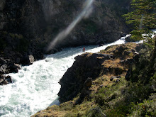
12/7 - Rio Nevados, Pucon, Chile
The Rio Nevados outside of Pucon, Chile is a total classic. Between the quality whitewater, awesome scenery, and proximity to town, this ranks as one of the better runs we´ve bagged on the trip. The water was a little low this day, so we started about 1km from the putin at the beginning of the big slide. This is a heady place to start the run as you peel out of the first eddy, bump 30 feet down some shallow rocks, and then go off a 15 foot slide into a 150 foot slide. Big start.

The view from the Upper putin bridge

Baker at the top of the 15 foot lead in

Nick lining up the lead in. You can also boof the rock on the left with a bit more water.

Nick down the gut

Nick about 15 seconds later down on the big slide

5 seconds after that, maybe 200 feet downstream...

Ben at the bottom of the slide

Baker pluggin in the rapid below the slide


The '15 footer', more like 20.


The entrance to the 25ish, about as wide as your boat...

Ben running

Looking back up at the drop

Ledges below the big waterfall

Tight drops below the scary ferry

Ben boofing right in 'Boof right'

Nick below the left-right-left-right drop

The muddy slog up to the car

Kiwi Nick rocking the tunes home in the Suby.
A small taste of the goodness that can be had just 20 minutes from Pucon. Good stuff. Perfect for a few laps a day.
12/4 - Rio Trancura Alto, Pucon, Chile
The Rio Trancura is the most popular comercial run outside of Pucon, Chile. Although the river is not particularly difficult, its proximity to Pucon and easy shuttle make it a popular run for the locals, and for commercial guests.

The river really only has 5 rapids and one portage. The rapids are all big water, pool-drop style. The first rapid is a huge horizon line after the tranquil first 1/4 mile. This can be run any which way, but has an easy tounge down the middle, or a tricky boulder dodge to the far left. The second rapid is the most difficult. The river splits around an island, and then drops significantly. The run is to the right of the island. The river then goes over/next to a huge boulder in the middle. You want to dodge right of the rock because behind it is a huge wave-hole that pushes into the right wall which is sieved out. Emma accidentally went into the sieved out part and swam through the sieve in her boat! Andy roped her from the rocks above, but it isn´t recomended. Stay left here.

The left channel in the second rapid re-enters below the rapid.

Looking back up at the second rapid, you can see the sieve on the left (river right)
The third rapid is a huge hole with a clean line down the left side. There are some big powerful waves and hydraulcs as you drop into the whiteness, but it is super clean. If you look back upstream from below this rapid, you can see the Pucon Volcano in the backdrop with the river. A beautiful spot.

Below this is the forth rapid (portage) followed by the fifth rapid. The portage is fairly obvious with a huge amount of gradient. You can boof the entrance drop to the left and then float down alongside the gnar before getting out to carry the main part of the drop. If you blow this boof, you would likely run the gnarly Class V+ portage rapid.
After the portage, you have one more big water Class IV+ rapid that is most easily run down the left side. You can takeout at the Trancura Rafting company on the right or at the bridge below.
Thursday, December 06, 2007
Across the Andes...
We've been hanging in Pucon, Chile for the past few days. There't tons of amazing boating and outfdoor stuff here. Paddled the upper Trancura River yesterday and the day before. May try to hit some other good stuff before the time is up.
We met up with a really amazing couple, Daia and Gregg. They've been walking for 17 months. Check the out at:
http://acrosstheandes.com/
That's all for now. On to the Futa, maybe?
JHB
We met up with a really amazing couple, Daia and Gregg. They've been walking for 17 months. Check the out at:
http://acrosstheandes.com/
That's all for now. On to the Futa, maybe?
JHB
Saturday, December 01, 2007
The long road to Chile...
Since the last post I did in fact get healthier. I think the Cipro helped. Machu Picchu and the Inca Trail were amazing (photos up at http://picasaweb.google.com/blumjonathan/MachuPicchuAndTiticaca)
Now I´m headed to Chile... but it going to be a long haul. Here´s the deal (I think...): I left Cuzco this morning at 8:30am headed to Puno. The goal is to get to the Peru-Chile border at Tacna. There are lots of busses from Cuzco to Tacna that go through Arequipa, which is lame because of the timing:
CUZ-ARE: 11 hours
ARE-TAC: 10 hours
CUZ-PUN: 6 hours
PUN-TAC: 10 hours
So its 5 extra hours on a bus to go from Cuzco to Tacna the way all the bus companies want you to. So, I´m in Puno waiting for a bus to go to Tacna. Hopefully, this bus will drop me in Tacna early enough to exercise one of two options:
1) Get a direct Tacna to Santiago (33 hours, US$100)
2) Save some money by taking a collectivo (3 hours, US$5? to Arica), then catching a bus from Arica to Santiago (31 hours, US$40)
Then we´ll see where the road leads. With a little luck, Ben, Baker, and Andy (and maybe Liz, Hootie, Drew, and Emily) will still be in Pucon, where I hope to meet them. If not, its another 12 hours south to the Futaleufu. I can´t wait to be back in the kayak firing off some of the great stuff Chile has to offer. More to come...
Friday, November 23, 2007
In the meanwhile...
Its been a bit since the last post, mostly for lack of boating... Here´s whats up:
Nov 11, my grandmother passed away at the age of 94 in Miami.
Nov 12, I got on a flight Cuzco to Lima, Lima to Panama, Panama to Miami.
Nov 13, I met up with the family in Miami.
Nov 14, funeral and family stuff.
Nov 15, more family stuff.
Nov 16, went to Lake Placid with Cousin Bryan for an awesome few days.
Nov 17, more Lake Plancid, getting sick off bad food.
Nov 18, Lake Placid and return to Miami to sleep in Airport for AM flight, more food sickness.
Nov 19, back to Lima, continued food illness.
Nov 20, back to Cuzco, feeling a bit better.
Nov 21, siteseeing in Cuzco, feeling ill again.
Nov 22, market in Pisac, still feeling ill.
Nov 23, laying low in Cuzco, feeling worse, took Cipro.
Nov 24, headed to Machu Pichu for Inca Trail, hopefully feeling better!
There is great irony in my sickness coming from Miami. After spending more than a month in Peru, drinking all the water, eating all the food off the street, eating the salads, all that, it took a few days in Miami to really mess me up... More to come after Machu Pichu, then down to Chile for Pucon, the Futa, and more rivers... Ciao.
Saturday, November 10, 2007
Some other sites...
Here are a few sites of other people traveling with me:
Liz´s stuff:
http://findingconsciousness.blogspot.com/
http://picasaweb.google.com/gingerwatergirl
My picasa with all the photos:
http://picasaweb.google.com/blumjonathan
This list will grow as more come up.
Liz´s stuff:
http://findingconsciousness.blogspot.com/
http://picasaweb.google.com/gingerwatergirl
My picasa with all the photos:
http://picasaweb.google.com/blumjonathan
This list will grow as more come up.
Friday, November 09, 2007
11/7-8 - Rio Paucartambo, Day 6/7
Getting off the Paucartambo was smooth but slow. The sunrise ferry came as promised at 5am sharp. The launch driver wanted 20 soles ($6.60) a person with our kayaks and we consented, knowing we could talk him down later. The driver was amazing cruising up the Urubamba against the current, running rapids, tipping the boat from side to side. It was like a 60 foot long wooden canoe with a 75hp outboard. We cruised on the 'Yoga':
 Ben and Jonathan on the 'Yoga':
 When we got to the small town at the end of the boat ride, there were a few busses waiting for us to begin their journey to Quillabamba. We got a 12 hour bus there for 18 soles each including out kayaks ($6). Its interesting that the luxury bus lines charge an arm and a leg to load a kayak, while the cheap chicken busses never even blink an eye. Sadly, this bus ride was long, spine jarring, hot and sweaty, and even stopped for an unexpected 2 hour lunch. The driver must have been hungry.
We arrived in Quillabamba around dark and went to the Cuzco bus station to get our tickets. We got an overnight to Cuzco for 20 soles each on the Luxury bus and then went to town, hoping to walk off the ride to Quillabamba before taking the ride to Cuzco. The market in Quillabamba was sweet, and I managed to get my board shorts stiched in the street for a sole. This was interesting because I didn't have other pants to put on or underwear. It took some convincing but they stitched them up for me. There was a ton going on in the streets with vendors, kids, acts, shops, and tons of motor taxis:
 The ride to Cuzco wasn't much of a sleeper, but we caught a minute here and there between the bumps. Upon arrival in Cuzco at 4:45am (24 hours after we caught the water taxi) we slept on the parked bus till 6am, headed to the Hostal, crashed hard. The Polica in Cuzco were confused by our kayaks, as usual:
 Out.
Out.
11/6 - Rio Paucartambo, Day 5
The highlight of Day 5 was the confluence of the Rio Paucartambo and Rio Urubamba. We started paddling at 8:30 and didn't stop till lunch at 1:15pm. We knew we had to be getting close but we didn't really know how close. I asked a local farmer how far at lunch and he said, 'Cerquita! 20 minutos!' (Very close!). Of course, he had never seen a kayak before, so we took this with a grain of salt. He was pretty close and 25 minutes later we were sitting in the eddy between the two rivers. Sucess! Self portrait of the crew in the eddy at the confluence of the Urubamba River and Paucartambo River:
 We paddled across the river here to ask when the next water taxi or bus would be passing by to pick us up. We had expected there to be some there or something which was unrealistic since we were in the middle of nowhere. Ben, Todd and Scott walked to a small 'town' where the drunk/sleeping/crazy radio controller guy was unhelpful. It turns out that we were in good luck because the water taxis only run on Monday and Wed (it was Sun) and the road is unpassable once it starts to rain (which it had been). We got mixed messages, but bottom line, boat leaves at 5am, be there at 4:45am and you might get it.
Some local kid, Daniel, invited us to stay on his property on river right. We watched in awe as he skillfully pilotted his 20 foot long wooden canoe across the Urubamba with fewer than 3 strokes. We followed in suit and were soon camped on the right side.
Andy pumping water from the Urubamba at the confluence: The house where we were invited to stay at the confluence:
 The rocks outside where we slept at the confluence:
Daniel was very hospitable, and we invited him to dinner with us. We also fed his dad and friends. He showed me how to scale a tree and cut down plantains to eat. Its really quite easy:
1) Find tree with plantains
2) Find machete
3) Hack into trunk of tree until it falls down
4) Pick up plantains off ground
The next morning was an early one for the sunrise ferry...
11/5 - Rio Paucartambo, Day 4
Flow guesses day 4:
J: 3150 4500
A: 3000 4350
B: 3200 4196
S: 2998 4450
T: 3000 4200
The guys who paddled the Paucartambo in 6-8 days clearly didn't know Andy Round, nor were paddling with him! We probably paddled an estimated 60-80km today, mostly flatwater. The amazing thing about the river was how just when you expected it to be done, you'd round a corner and be faced with more great whitewater. It just kept going. The jungle scenery got better and better, with dense, lush, green folliage, birds, and of course, the jungle humidity. It was HOT! Jungle butterflys like the green Mystic:
 We began the day at 8:15 and paddled mostly flatwater until we got to a HUGE rapid around 11:30. This was a stomper. The whole river (at least 4,000cfs) crashing down over fairly steep gradient. It was awesome! This rapid was in a huge open valley with some braided channels. The right side had a bit of a sneak Class II line with 300cfs or so, but the main flow was unreal. Andy ferried down to the eddy on the left side, and signaled that I should come down and take a look. The move was difficult and as I caught the eddy, I clipped a rock under my hull. As I slid slowly off the rock, my stern caught and I flipped over right above this massive rapid. I hit a quick roll and oriented myself just in time to hear Andy yell, 'Left then right' and drop backwards into the brown maelstrom of holes and waves. Dropping blindly into a rapid where you can barely see over the wave in front of you is interesting because you don't know what's coming, but you can't focus too much on what's in front of you. You need to look at the bigger picture. It all went well and I made it through to the bottom right, no problem. Tood for scale inthe middle of the main drop:
 This big water canyon continued on for another 15 minutes of huge holes, towering waves and great fun. It was the highlight of Day 4. We paddled till 3:45, passing under the blue Puente Penetracion at a small town. Pierro had told us we could take out there, but we kinda missed it and all had our sights set on the Urubamba confluence. The camp that night was hot and humid on wet jungle black sand beaches:

I think Day 4 was the longest I have ever paddled in one day. Sitting for the hours was painful but rewarding, reminicient of rowing crew in high school. After 4 days of being in wet, stinky gear, the jungle made me long for a cold shower and clean clothing. A difficult but fulfilling day for the team.
J: 3150 4500
A: 3000 4350
B: 3200 4196
S: 2998 4450
T: 3000 4200
The guys who paddled the Paucartambo in 6-8 days clearly didn't know Andy Round, nor were paddling with him! We probably paddled an estimated 60-80km today, mostly flatwater. The amazing thing about the river was how just when you expected it to be done, you'd round a corner and be faced with more great whitewater. It just kept going. The jungle scenery got better and better, with dense, lush, green folliage, birds, and of course, the jungle humidity. It was HOT!
 Jungle butterflys like the green Mystic:
 We began the day at 8:15 and paddled mostly flatwater until we got to a HUGE rapid around 11:30. This was a stomper. The whole river (at least 4,000cfs) crashing down over fairly steep gradient. It was awesome! This rapid was in a huge open valley with some braided channels. The right side had a bit of a sneak Class II line with 300cfs or so, but the main flow was unreal. Andy ferried down to the eddy on the left side, and signaled that I should come down and take a look. The move was difficult and as I caught the eddy, I clipped a rock under my hull. As I slid slowly off the rock, my stern caught and I flipped over right above this massive rapid. I hit a quick roll and oriented myself just in time to hear Andy yell, 'Left then right' and drop backwards into the brown maelstrom of holes and waves. Dropping blindly into a rapid where you can barely see over the wave in front of you is interesting because you don't know what's coming, but you can't focus too much on what's in front of you. You need to look at the bigger picture. It all went well and I made it through to the bottom right, no problem. Tood for scale inthe middle of the main drop:
 This big water canyon continued on for another 15 minutes of huge holes, towering waves and great fun. It was the highlight of Day 4. We paddled till 3:45, passing under the blue Puente Penetracion at a small town. Pierro had told us we could take out there, but we kinda missed it and all had our sights set on the Urubamba confluence. The camp that night was hot and humid on wet jungle black sand beaches:
I think Day 4 was the longest I have ever paddled in one day. Sitting for the hours was painful but rewarding, reminicient of rowing crew in high school. After 4 days of being in wet, stinky gear, the jungle made me long for a cold shower and clean clothing. A difficult but fulfilling day for the team.
Subscribe to:
Posts (Atom)